Nashville Map Poster: Music City on a bend of the Cumberland
Why Nashville works so well as a map poster
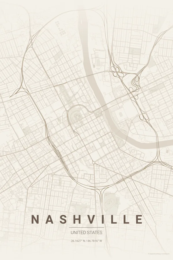
Nashville's map turns on the Cumberland River, which throws a series of tight loops right through the city and wraps downtown on two sides. Inside the bend sits the compact grid of Lower Broadway and the Capitol hill, with the pedestrian bridge reaching across to the stadium on the east bank.
Beyond the core, the interstates draw a bold loop around downtown before splitting off toward Memphis, Louisville and Chattanooga, while Music Row, the Gulch and Germantown each add their own patch of texture. Centennial Park and its Parthenon anchor the west end of the frame.
Best palettes for Nashville
- Warm Beige — the signature pick: warm, honeyed neutrals with the soft feel of an old country record sleeve.
- Noir — black on black with honky-tonk neon energy in its restraint.
- Midnight Blue — the river bend glows against deep navy like Broadway at midnight.
Where to centre the map and which radius to use
Centre on the State Capitol with a 5 km radius: the Cumberland loops, Lower Broadway, the stadium, Music Row and Centennial Park all land in frame, with the interstate ring giving the poster a natural border.
Ready-made Nashville posters
We have already rendered 5 Nashville designs at 300 DPI (Warm Beige, Blueprint, Japanese Ink, Midnight Blue, Noir). Download the files for 9.99 € and print them anywhere, or order a premium matte print (A4 to 60×90 cm) with shipping included.

See all Nashville designs Order it printed
Design your own Nashville poster
Pick any of the 17 palettes, set the exact centre and radius described above, choose the size and the label text (Nashville, or a neighbourhood name), and we render it for you from live map data after checkout. From 14 €, usually ready in 5–15 minutes.
Which size to print
City maps with lots of fine streets reward size: 30×40 cm is the sweet spot for a desk or hallway, 50×70 cm and 60×90 cm turn the map into a statement piece where individual streets remain legible from across the room. Stick to matte paper so the dark palettes do not reflect. Read the printing and framing guide.