New Zealand · Warm Beige
Auckland Map Poster · Warm Beige
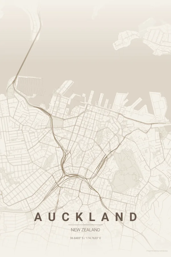
Every street, park and waterway of Auckland, drawn from real map data in the Warm Beige palette. Buy the files and print anywhere, or let us print it for you.
- Digital: 4 portrait JPGs (2:3, 3:4, 4:5, ISO) at 300 DPI
- Fits 12×18 in, 30×40 cm, 16×20 in, A4/A3/A2 and more
- Extras ZIP with the 11×14 in version and all ratios in landscape
- Printed sizes A4 to 60×90 cm, €29.90–€65, shipping included
- Map data © OpenStreetMap contributors
About the Auckland map
a city squeezed between two harbours
Auckland occupies one of the strangest sites of any major city: a narrow volcanic isthmus with the Waitematā Harbour on one side and the Manukau Harbour on the other, so water pushes into the map from both directions and the coastline does most of the artistic work.
On top of that sit the volcanoes. Perfect green circles mark Mount Eden, One Tree Hill and a dozen other cones, punching craters into the suburban street fabric, while the Harbour Bridge stretches across to the North Shore and bays scallop the whole eastern edge.
Centre on the Sky Tower with an 8 km radius so both harbours squeeze the isthmus in frame, with Mount Eden, One Tree Hill and the Harbour Bridge all inside the composition.
Read the full Auckland guideWant it your way?
Change the distance, the colours, the label or the size in the editor and get a custom render of Auckland.
Customize this design