United Kingdom · Blueprint
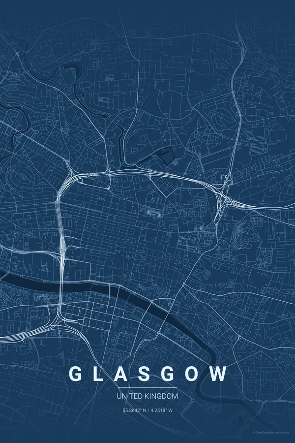
Glasgow Map Poster · Blueprint
Every street, park and waterway of Glasgow, drawn from real map data in the Blueprint palette. Buy the files and print anywhere, or let us print it for you.
- Digital: 4 portrait JPGs (2:3, 3:4, 4:5, ISO) at 300 DPI
- Fits 12×18 in, 30×40 cm, 16×20 in, A4/A3/A2 and more
- Extras ZIP with the 11×14 in version and all ratios in landscape
- Printed sizes A4 to 60×90 cm, €29.90–€65, shipping included
- Map data © OpenStreetMap contributors
About the Glasgow map
the Clyde and Britain's great Victorian grid
Glasgow is that rare thing: a British city with a proper grid. The Victorian blocks of the Merchant City and the city centre march west over Blythswood Hill in confident straight lines, with George Square at their heart — a pattern that owes more to Chicago than to London.
The River Clyde cuts the composition east to west, remembering the shipyards that built the city, while the West End answers with the curling terraces of Kelvingrove, the River Kelvin and the university, and Glasgow Green opens up the east. The M8 slicing around the centre adds a brutal, honest edge.
Blueprint: the signature pick: a technical drawing for the city that drew the world's ships.
Centre on George Square with a 5 km radius: the Victorian grid, the Clyde and its old shipyard banks, Kelvingrove Park, the university and Glasgow Green all sit comfortably inside the frame.
Read the full Glasgow guideWant it your way?
Change the distance, the colours, the label or the size in the editor and get a custom render of Glasgow.
Customize this design