Spain · Noir
Madrid Map Poster · Noir
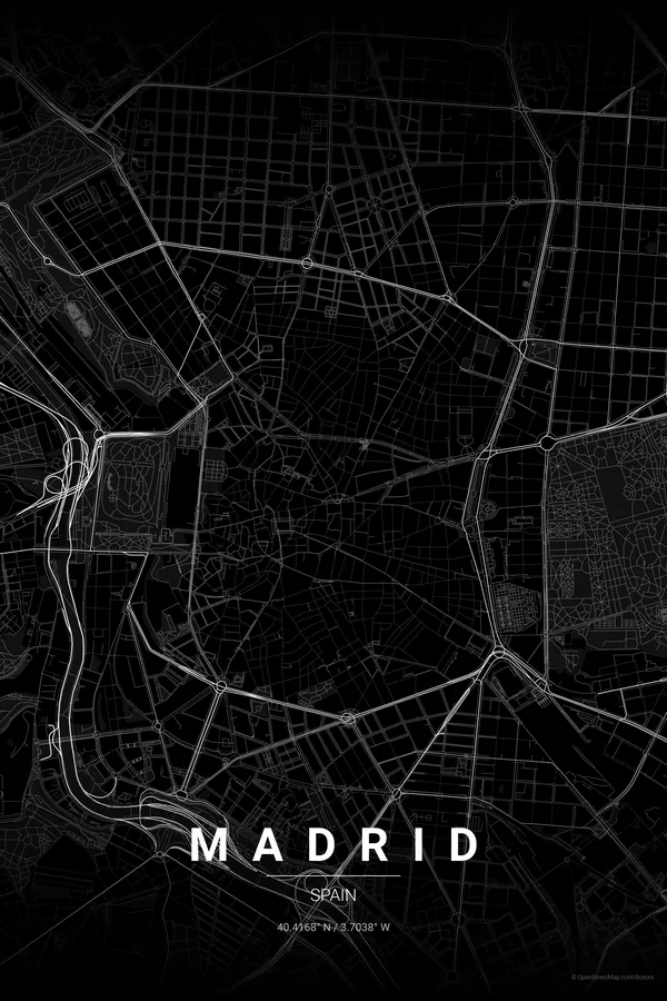
Every street, park and waterway of Madrid, drawn from real map data in the Noir palette. Buy the files and print anywhere, or let us print it for you.
- Digital: 4 portrait JPGs (2:3, 3:4, 4:5, ISO) at 300 DPI
- Fits 12×18 in, 30×40 cm, 16×20 in, A4/A3/A2 and more
- Extras ZIP with the 11×14 in version and all ratios in landscape
- Printed sizes A4 to 60×90 cm, €29.90–€65, shipping included
- Map data © OpenStreetMap contributors
About the Madrid map
radial avenues, the Retiro and the Austrias
Madrid grows in rings from the Puerta del Sol — kilometre zero of Spain's road network. The medieval knot of Los Austrias gives way to the elegant grid of Salamanca, the Gran Vía slices through the centre, and the green rectangles of the Retiro and Casa de Campo anchor the composition.
As a poster the city reads wonderfully: a dense radial heart, the Castellana running north like a spine, and the M-30 drawing a soft boundary. It is a map that feels both organic and orderly, like the city itself.
Noir: elegant black-on-black for a print that goes with any interior.
Centre on the Puerta del Sol with a 5 km radius to catch the Retiro, Salamanca, Chamberí and the river in one frame. A 3 km radius gives you the Austrias, Malasaña and Lavapiés in full detail — perfect if your Madrid is the walking city.
Read the full Madrid guideWant it your way?
Change the distance, the colours, the label or the size in the editor and get a custom render of Madrid.
Customize this design