Iceland · Noir
Reykjavik Map Poster · Noir
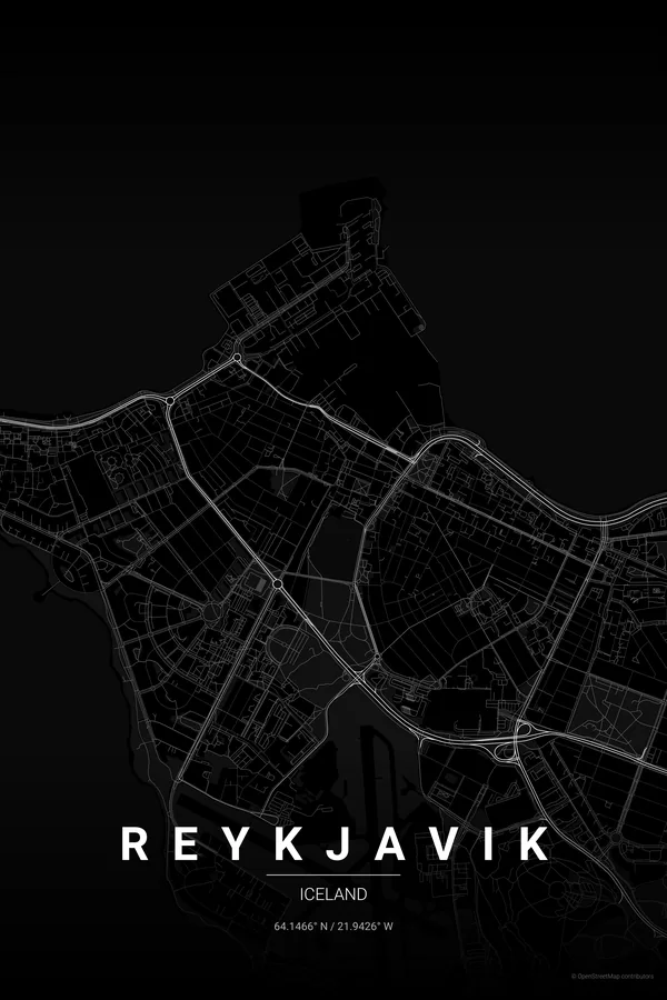
Every street, park and waterway of Reykjavik, drawn from real map data in the Noir palette. Buy the files and print anywhere, or let us print it for you.
- Digital: 4 portrait JPGs (2:3, 3:4, 4:5, ISO) at 300 DPI
- Fits 12×18 in, 30×40 cm, 16×20 in, A4/A3/A2 and more
- Extras ZIP with the 11×14 in version and all ratios in landscape
- Printed sizes A4 to 60×90 cm, €29.90–€65, shipping included
About the Reykjavik map
the world's northernmost capital, drawn by the sea
Reykjavik sits on a peninsula reaching into Faxaflói bay, so the sea draws the map before the streets do: coastline wraps the frame on three sides, with the Old Harbour notching the north edge and the Seltjarnarnes spit trailing off to the west. In the middle, the small dark rectangle of Tjörnin pond anchors the old town.
The streets of the 101 district fan out from the hilltop church of Hallgrímskirkja, with Laugavegur threading through them as the city's long main street. It is a compact, low, wonderfully legible map — a capital you can take in at a single glance, framed by open water.
Centre on Hallgrímskirkja with a 3 km radius: the whole peninsula fits, from the Old Harbour and Tjörnin to the Seltjarnarnes shoreline, with the sea framing the streets on three sides of the poster.
Read the full Reykjavik guideWant it your way?
Change the distance, the colours, the label or the size in the editor and get a custom render of Reykjavik.
Customize this design