South Korea · Warm Beige
Seoul Map Poster · Warm Beige
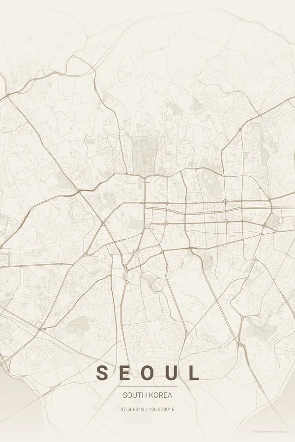
Every street, park and waterway of Seoul, drawn from real map data in the Warm Beige palette. Buy the files and print anywhere, or let us print it for you.
- Digital: 4 portrait JPGs (2:3, 3:4, 4:5, ISO) at 300 DPI
- Fits 12×18 in, 30×40 cm, 16×20 in, A4/A3/A2 and more
- Extras ZIP with the 11×14 in version and all ratios in landscape
- Printed sizes A4 to 60×90 cm, €29.90–€65, shipping included
About the Seoul map
mountains, river and mega-city energy
Seoul's map tells the story of a city built between mountains and a river. The Han cuts horizontally through the centre, wide and bridged dozens of times, with the islands of Yeouido and Nodeul midstream. To the north, Bukhansan makes a mountainous edge where the city simply stops; to the south, Gangnam's grid stretches endlessly.
The contrast between the two halves is fascinating: north of the Han, older, organic streets cluster around Gyeongbokgung and the hanok lanes of Bukchon and Insadong; south of the river, the wide boulevards and apartment complexes built from the 1970s on create a completely different texture.
Use a 7 km radius centred on Yongsan to capture both banks of the Han, the mountains to the north and the full breadth of the bridges; the horizontal river gives the poster a balanced, cinematic split.
Read the full Seoul guideWant it your way?
Change the distance, the colours, the label or the size in the editor and get a custom render of Seoul.
Customize this design